Addressing Resiliency in Denver with Equity and Inclusion at the Forefront
A story of how City of Denver protects the community, increases connectivity, enhances and increases green spaces, and upgrades its infrastructure using innovative green infrastructure.

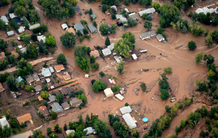
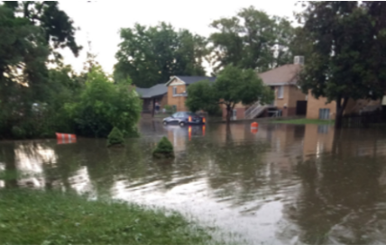
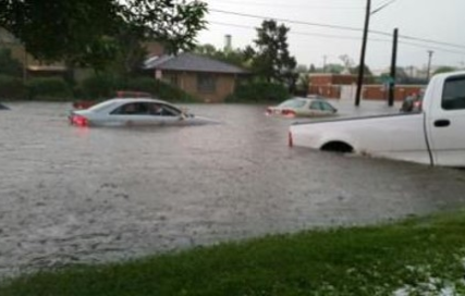
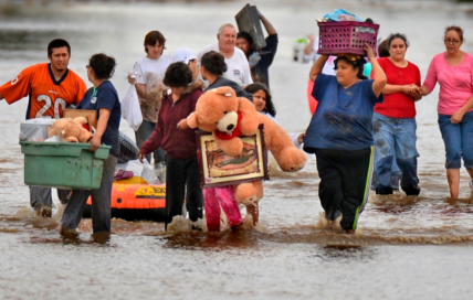
Colorado Floods
In 2013 and numerous flooding events before that time, Colorado experienced unprecedented flooding which caused the loss of lives, destruction of property and the evacuation of more than 11,000 people in some of our most vulnerable neighborhoods.
Image credit: Denver Post
Environmental Challenges of an Urban Watershed
The urban watersheds in Denver present environmental challenges, including dense urban fabric, aging and undersized pipes, no natural drainage way and 15.25 square miles of collection area – all attributing to significant flooding challenges.
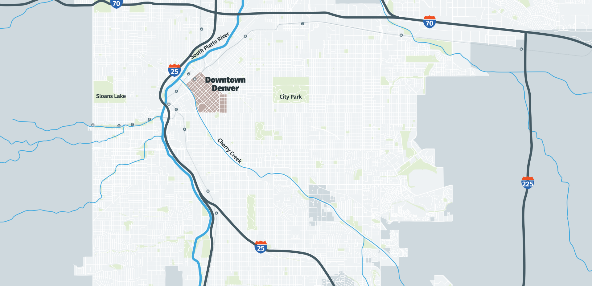
City of Denver
The South Platte River is the central spine running through our city, and like many cities, our major highway runs in a similar alignment. The west side of Denver has more topography and natural drainages, but the east side of Denver mainly has Cherry Creek.
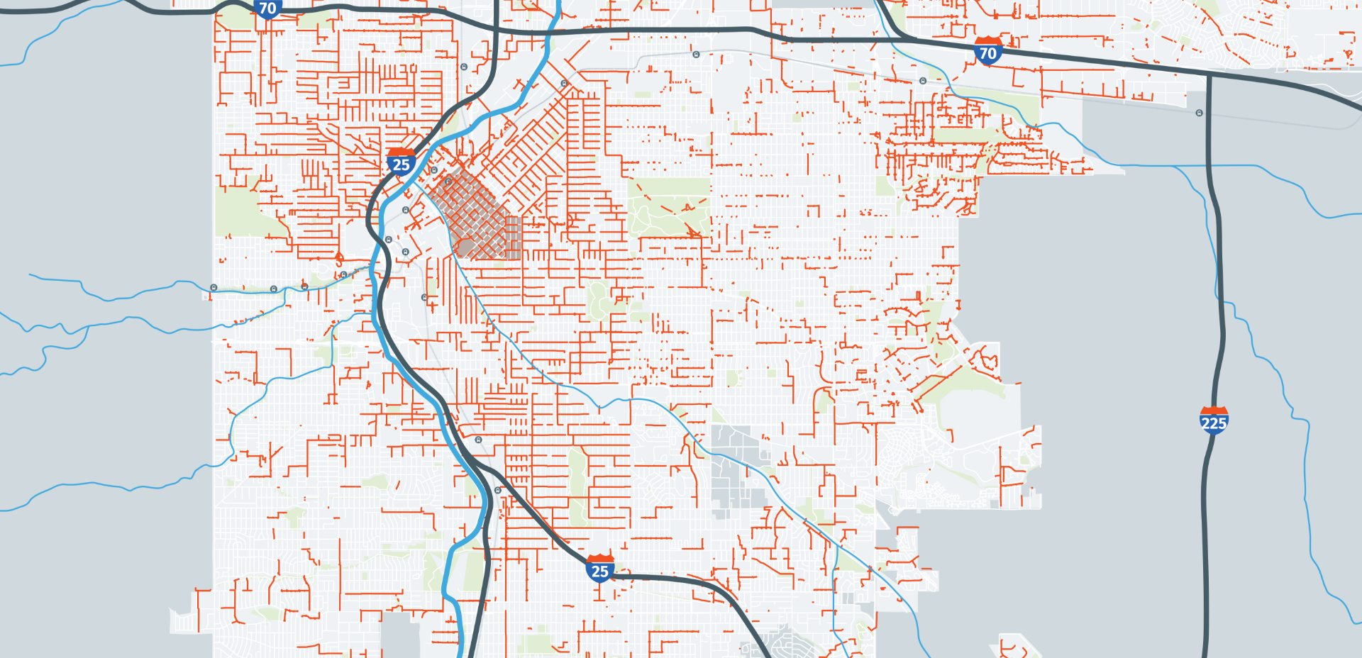
Aging stormwater infrastructure
The City of Denver has grown from a city of about 130,000 in 1900 to over 700,000 today. The pipes and stormwater infrastructure (shown in red) that were built for a population in the early 1900’s are no longer sufficient. They are too small to carry the amount of stormwater we see today.
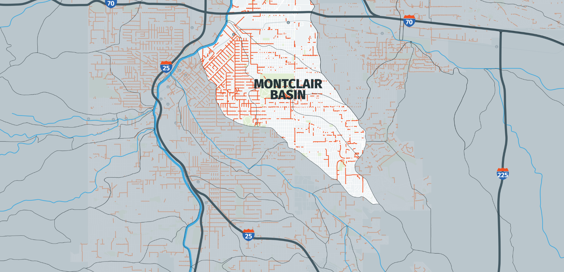
Largest basin without defined open waterway
The Montclair Basin is the city’s largest basin (10.9 square miles) without a defined open waterway. The Montclair basin experiences a high flood risk because of its large size, being fully developed, relatively flat, and lacks an adequate ‘backbone’ drainage system.
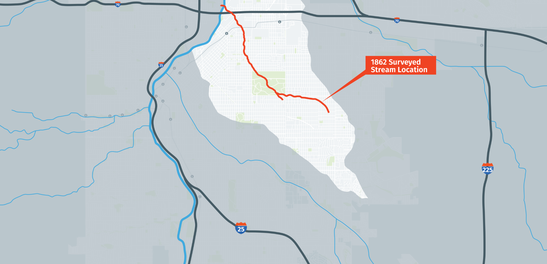
Historic stream location
As we analyzed the watershed and its history, we found that there was a historic stream location that ran through this watershed but has since been built over from decades of urban housing and development.
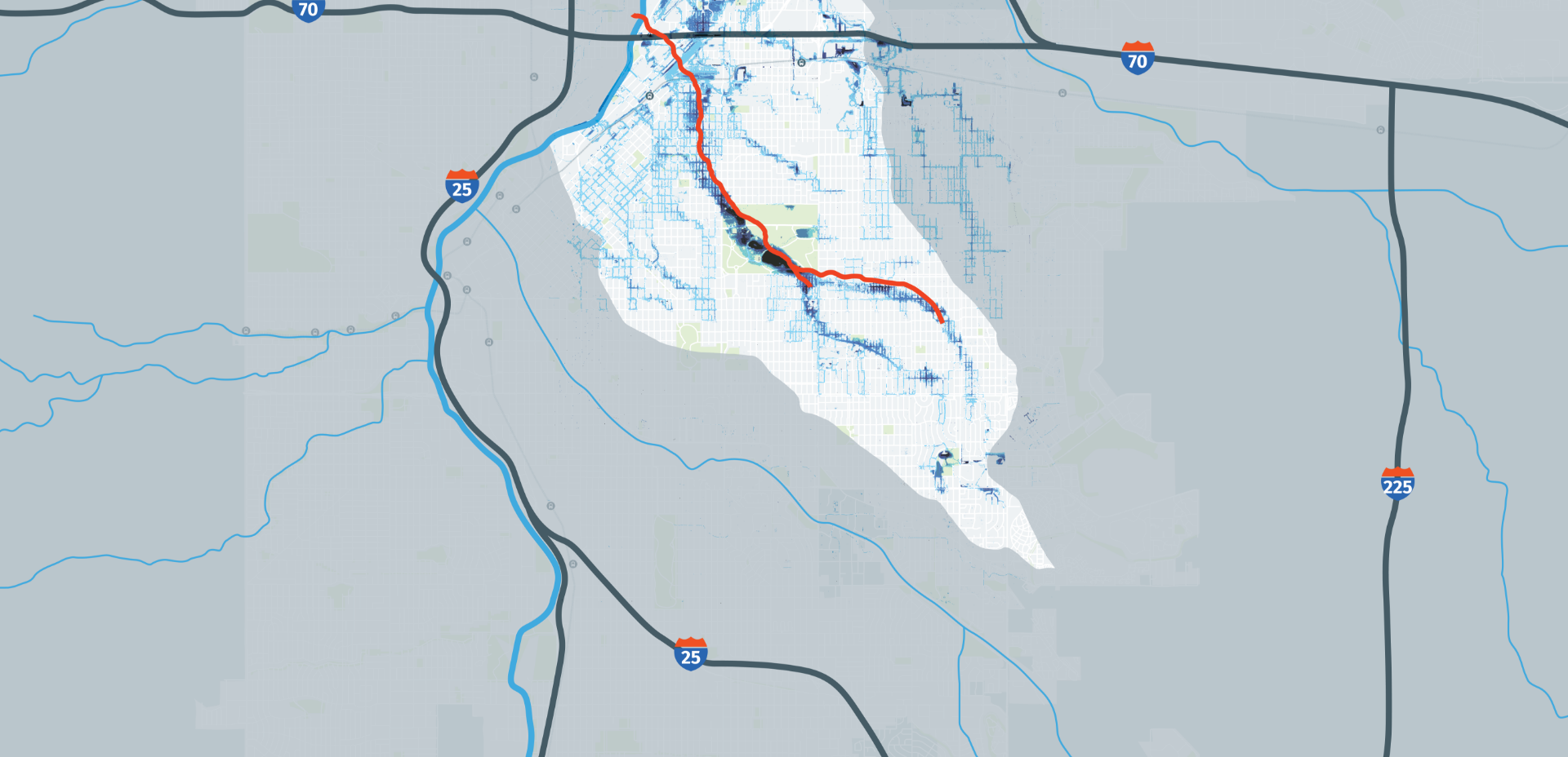
Stormwater Modeling
Stormwater modeling shows that during moderate to large storm events, the existing pipe systems reach capacity and the excess runoff is carried on the surface at depths of 3 to 5 feet or more over multiple city blocks (shown in blue). The estimated flood risk in the Montclair Basin alone is in the hundreds of millions of dollars.
Neighborhoods within Montclair Basin
The neighborhoods most affected are primarily low income and minority occupied with only seven percent of land dedicated to open space. The project aims to address these inequities through open spaces and infrastructure enhancements.

7%
of total area is open space

54%
Households with income less than 100% of Denver's Median Income (<$60,000)
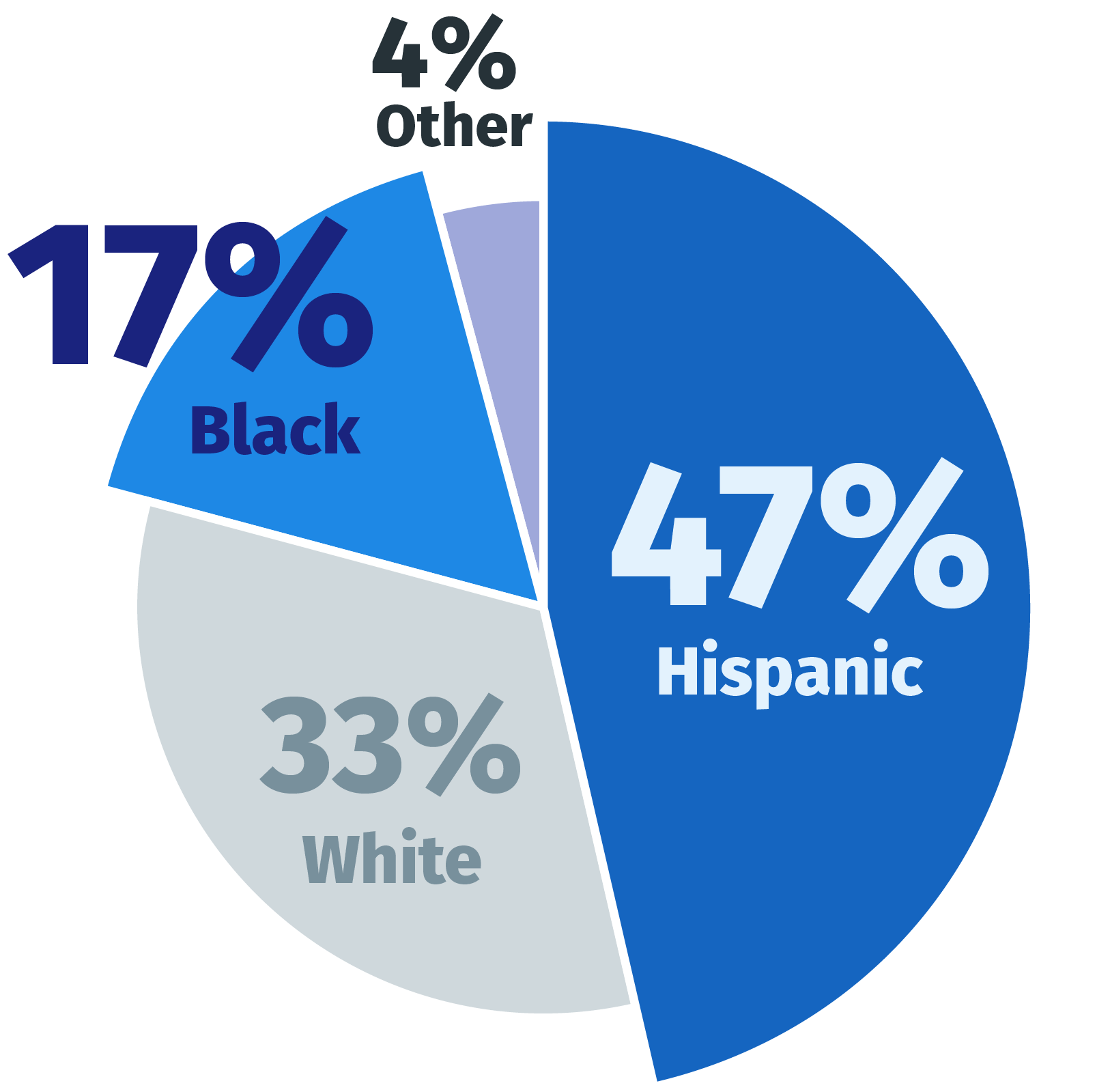
Ethnicity
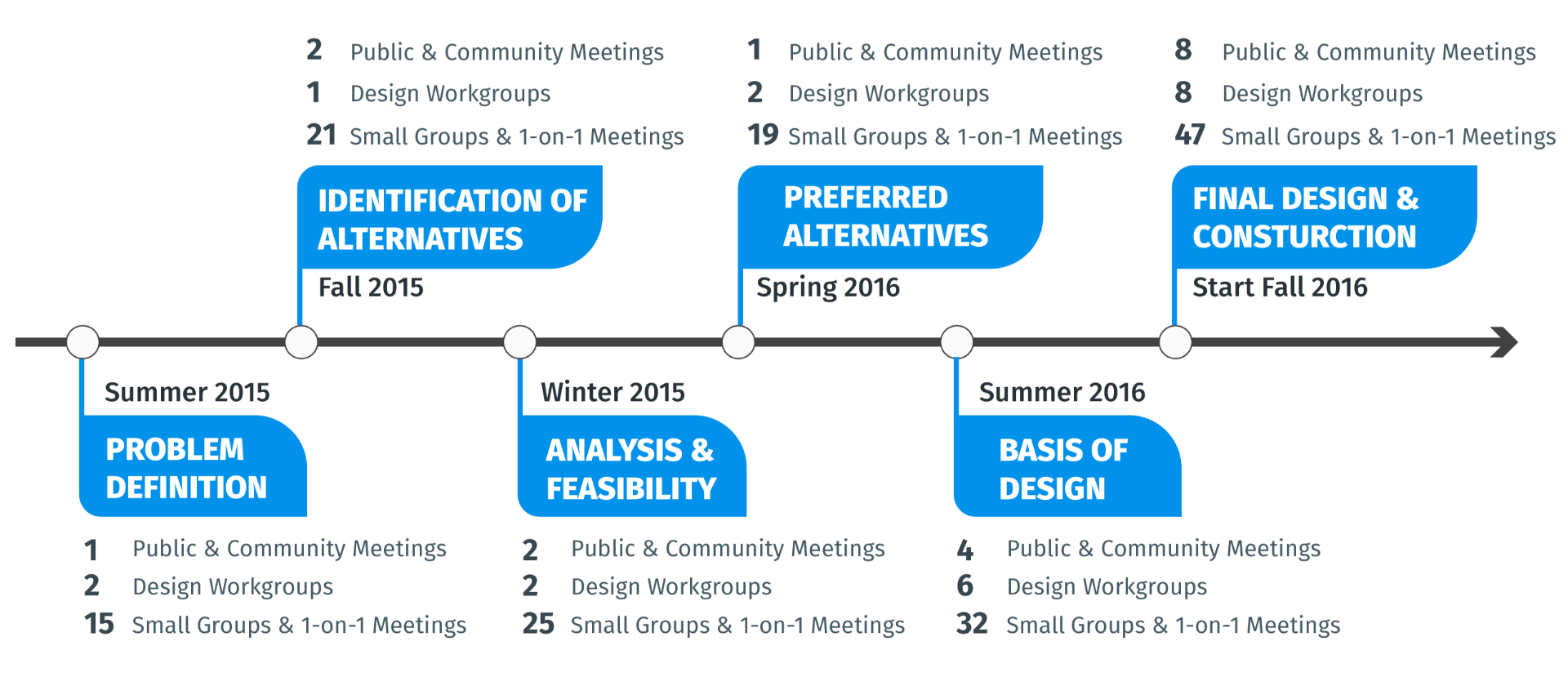
A Robust Community Engagement Process
Throughout the process, the City and various partners undertook a robust planning and engagement process, including more than 250 public and stakeholder meetings, to educate, inform and work with the community to help shape the alternatives.
The Client
City and County of Denver
- Mayor's Office
- Transportation & Infrastructure
- Parks & Recreation
- Community Planning & Development
Expertise
- Landscape Architects
- Urban Designers
- Planners
- Drainage Engineers
- Civil Engineers
- Geotech Engineers
- Public Outreach
Key Partners
- Colorado Department of Transportation
- Regional Transportation District
- Mile High Flood District
- US Army Corps of Engineers
Between summer 2015 and winter 2016, there were...
250+ Public and Stakeholder Meetings
Multi-Layered Benefits
The planning was guided by five key goals which focused on multi-layered benefits addressing the historic environmental and social challenges, including improved water quality, reduced flooding, providing new access to neighborhood parks and increased amenities and connectivity.
Reduced Flooding to Diverse Neighborhoods
Integrated Infrastructure and Water Quality
Improved Neighborhood Connectivity
Enhanced Existing City-Wide Recreational Assets
Provided New Neighborhood Park Amenities
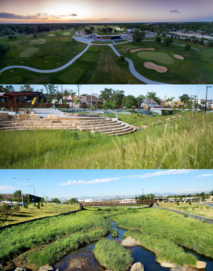
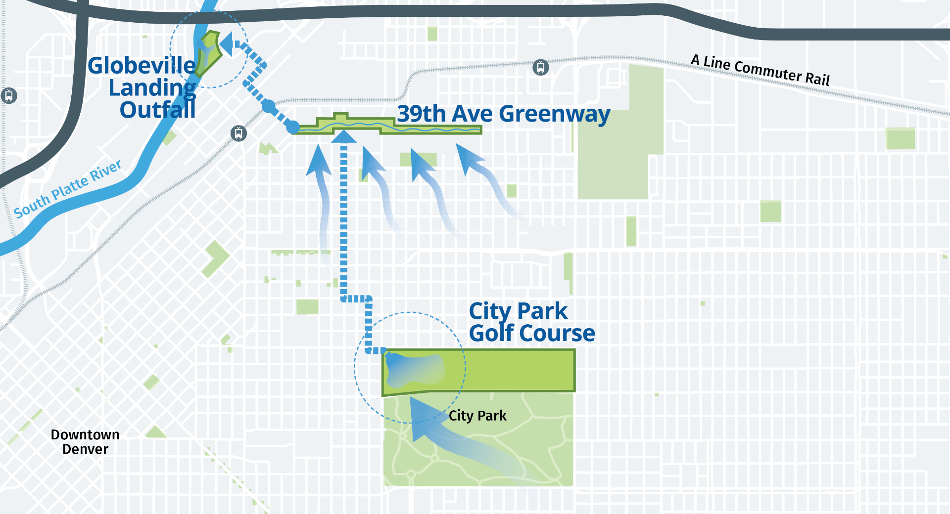
Three Interconnected Projects
A full and comprehensive alternatives analysis and evaluation was undertaken that repositioned the project into one that utilizes publicly-owned land and minimizes impact and acquisitions in underserved and low-income neighborhoods while creating community benefits.
The program solution packaged three primary projects within the Montclair Basin to address detention, stormwater conveyance and water quality.
The three-part strategy included a redesign of City Park Golf Course as a multifunctional detention and recreational amenity; a new open space greenway with playgrounds, trails and new public spaces along 39th Avenue; and an enhanced riverfront park with improved amenities and ecological habitat at Globeville Landing Park.
City Park Golf Course
Enhance + Detain
The City Park Golf Course was selected to serve as a primary detention area for the program as it is located within a strategic location relative to the Montclair Basin within a low area where stormwater naturally flows but high enough in the basin to complement conveyance improvements down stream. The golf course is listed on the National Register of Historic Places so a thoughtful approach was necessary to preserve the integrity of the original course and to guide the planning and design of the changes to the course.
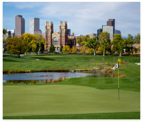
Integrated green infrastructure is used to accommodate storm events as well as a water feature in the new golf course, creating a shared benefit for the entire community.
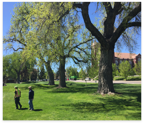
City Park Golf Course is a historic and treasured course in Denver. Preserving its historical significance was a top priority, resulting in the preservation of 99 percent of high priority trees and retaining historic views to the Rocky Mountains.
39th Avenue Greenway
Gather + Convey
Through the alternatives analysis process the need for a greenway was identified to collect stormwater within the Montclair Basin and to convey the water to the South Platte River. The 39th Avenue Greenway is the heart of the program. This new greenway corridor fulfills community desires for increased connections and new amenities, while acting as a conveyance for stormwater. The greenway is a 1-mile-long new green space extending across the Cole and Clayton neighborhoods, improving connectivity between the neighborhoods. It integrates new bike and pedestrian paths, playgrounds, plaza spaces and community gardens with a new open conveyance and water quality channel.
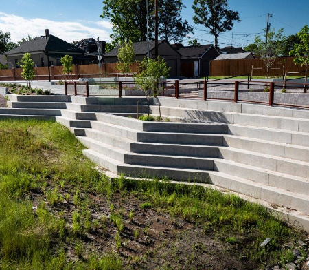
The Greenway, working as a stormwater infrastructure, also functions as an inhabitable public space for communities to gather at new green spaces, using the multi-use path and the pedestrian promenade.
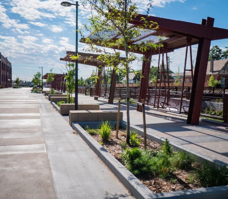
To reduce impact to private property, new forms of public space were explored where all modes of transportation share the same space, reducing the amount needed. Denver’s first shared street has been designed adjacent to the 39th Ave Greenway.
Globeville Landing Outfall Park
Improve + Release
Improvements to Globeville Landing Park were identified due to this park being the location where stormwater is released to the South Platte River. This project required design for two interrelated elements — significant water quality and the park redesign. Through robust engagement on the park design, the community expressed a desire for playgrounds, grassy areas, gathering areas and safety improvements. In regard to the drainage elements and water quality, the City opted to design an open, natural storm water drainage channel, offering opportunities for environmental education, providing habitat for wildlife and ecosystem restoration, and improving water quality into the South Platte River.
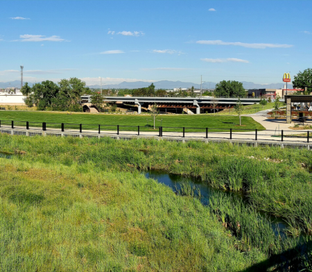
New water quality treatment system.
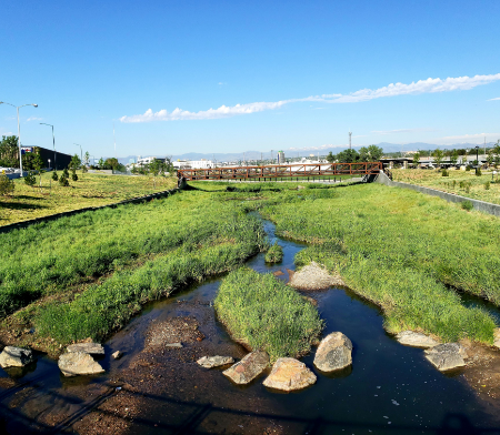
Improved river ecology for the river while providing an enhanced park for families to gather.
Project Achievements
Denver's
First Shared Street
- 39th Avenue from Franklin Street to Williams Street
Created 8,450 linear feet of
new open wetland channel
Provides 5,079 properties with additional flood protection
14 Acres of new park amenities and gathering spaces in historically underserved neighborhoods
Second UV treatment in Denver at Globeville Landing Outfall
3,102 cubic ft capacity of debris with installation 3 new trash vaults
Protection of culturally and historically significant structures, including the High Street Bar, Rock Drill, and Medical Depot properties
Preservation of 99% of priority trees in City Park Golf Course
Golf course 18.94% increase in revenue from 2017 to 2020
2 miles of new bicycle and pedestrian facilities
Project Flythrough
As Denver’s first major green infrastructure project, the planning effort now sets a precedent for community engagement, flood protection and infrastructure design in urbanized neighborhoods with predominantly low-income and minority residents. The planning process put flood protection and infrastructure at the forefront of a community conversation to enhance a historic golf course, create a new greenway and improve a riverfront space.